 vesseltracker.com
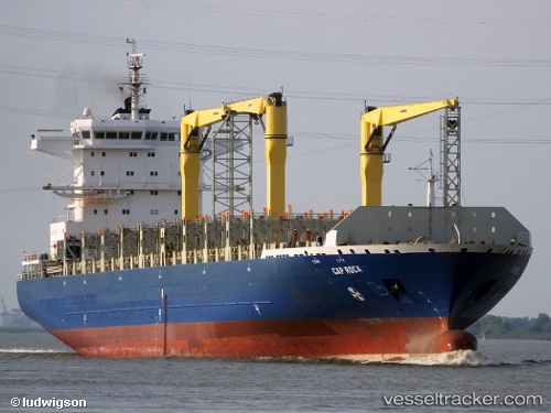
 SONGA PUMA
Current Status
Where is the vessel?
SONGA PUMA is currently in 12 nm N of Quebradillas, based on AIS data received less than 1h ago.
Latest AIS update:
Current position: 18.65321° N, 66.86190° W (12 nm N of Quebradillas)
Average speed (last 7 days): Loading…
Average speed (last 30 days): Loading…
Vessel profile: SONGA PUMA is a Container Ship with dimensions 31m x 225m.
This page combines live AIS, route history, probable destination signals, nearby traffic, and port activity for practical vessel monitoring.
The current position of vessel SONGA PUMA is 18.65321 lat / -66.86190 lng. Updated: 2026-05-13 04:34:41 UTCNearest reference points:
- Near San Juan
- Near Guanica
- Near Roosevelt Roads
Currently sailing under the flag of Liberia ![]()
SONGA PUMA built in 2009 year
Deadweight:
34700 tDetails:
Live Vessel SONGA PUMA Analytics (details, animations, etc.)
Recent AIS points (UTC):
2026-05-13 01:09:46 UTC · 18.56442, -67.61633 · SOG 16.3 kn · COG 56°2026-05-13 02:37:51 UTC · 18.66254, -67.27685 · SOG 12.2 kn · COG 91°
2026-05-13 04:02:02 UTC · 18.65587, -66.97880 · SOG 12.1 kn · COG 92°
2026-05-13 04:34:41 UTC · 18.65321, -66.86190 · SOG 12.2 kn · COG 91°