 vesseltracker.com
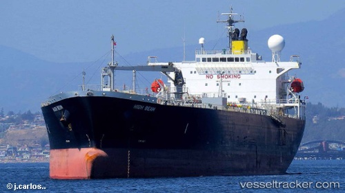
 IMPERIAL
Current Status
Where is the vessel?
IMPERIAL is currently in 81 nm SE of HAMBANTOTA, based on AIS data received about 1h ago.
Latest AIS update:
Current position: 4.90833° N, 81.67667° E (81 nm SE of HAMBANTOTA)
Average speed (last 7 days): Loading…
Average speed (last 30 days): Loading…
Vessel profile: IMPERIAL is a Oil Products Tanker with dimensions 180m x 32m.
This page combines live AIS, route history, probable destination signals, nearby traffic, and port activity for practical vessel monitoring.
The current position of vessel IMPERIAL is 4.90833 lat / 81.67667 lng. Updated: 2026-04-03 03:18:54 UTCNearest reference points:
- 53 nm SE of Konwelana
- 75 nm E of Konwelana
- 79 nm E of Konwelana
Currently sailing under the flag of Liberia ![]()
IMPERIAL built in 2009 year
Deadweight:
46646 tDetails:
Live Vessel IMPERIAL Analytics (details, animations, etc.)
Recent AIS points (UTC):
2026-04-02 21:31:54 UTC · 4.81167, 80.48500 · SOG 12 kn · COG -1°2026-04-03 00:17:50 UTC · 4.84667, 81.05833 · SOG 12 kn · COG -1°
2026-04-03 00:57:04 UTC · 4.85667, 81.19500 · SOG 12 kn · COG -1°
2026-04-03 03:18:54 UTC · 4.90833, 81.67667 · SOG 12 kn · COG -1°