 vesseltracker.com
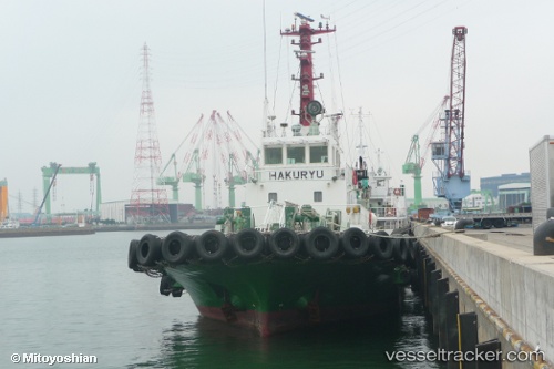
 HAKURYU MARU
Current Status
Where is the vessel?
HAKURYU MARU is currently in Near Ikitsuki, based on AIS data received about 1h ago.
Latest AIS update:
Current position: 33.46108° N, 129.42645° E (Near Ikitsuki)
Average speed (last 7 days): Loading…
Average speed (last 30 days): Loading…
Vessel profile: HAKURYU MARU is a Tug with dimensions m x m.
This page combines live AIS, route history, probable destination signals, nearby traffic, and port activity for practical vessel monitoring.
The current position of vessel HAKURYU MARU is 33.46108 lat / 129.42645 lng. Updated: 2026-05-16 14:23:49 UTCNearest reference points:
- 15 nm N of TSUKINOKAWA
- Near TSUKINOKAWA
- Near Fukushima, Nagasaki
Currently sailing under the flag of Japan ![]()
Details:
Live Vessel HAKURYU MARU Analytics (details, animations, etc.)
Recent AIS points (UTC):
2026-05-16 10:32:56 UTC · 33.59500, 129.70166 · SOG 5 kn · COG -1°2026-05-16 12:06:02 UTC · 33.53833, 129.56332 · SOG 4 kn · COG -1°
2026-05-16 12:56:56 UTC · 33.51500, 129.50667 · SOG 3 kn · COG -1°
2026-05-16 14:23:49 UTC · 33.46108, 129.42645 · SOG 3.3 kn · COG 233°