 vesseltracker.com
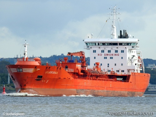
 Stavfjord
Current Status
Where is the vessel?
Stavfjord is currently in 14 nm N of Hirtshals, based on AIS data received less than 1h ago.
Latest AIS update:
Current position: 57.83914° N, 9.99607° E (14 nm N of Hirtshals)
Average speed (last 7 days): Loading…
Average speed (last 30 days): Loading…
Vessel profile: Stavfjord is a Chemical Oil Products Tanker with dimensions 144m x 23m.
This page combines live AIS, route history, probable destination signals, nearby traffic, and port activity for practical vessel monitoring.
The current position of vessel Stavfjord is 57.83914 lat / 9.99607 lng. Updated: 2026-05-15 07:37:55 UTCNearest reference points:
- 15 nm N of Hirtshals
- Near Hirtshals
- Near SKAGEN
Currently sailing under the flag of Norway ![]()
Stavfjord built in 2009 year
Deadweight:
16635 tDetails:
Live Vessel Stavfjord Analytics (details, animations, etc.)
Recent AIS points (UTC):
2026-05-15 04:41:44 UTC · 57.82832, 10.91456 · SOG 9.8 kn · COG 305°2026-05-15 06:19:32 UTC · 57.85713, 10.41999 · SOG 10.3 kn · COG 264°
2026-05-15 07:09:55 UTC · 57.84543, 10.14590 · SOG 10.3 kn · COG 265°
2026-05-15 07:37:55 UTC · 57.83914, 9.99607 · SOG 10.3 kn · COG 265°