 vesseltracker.com
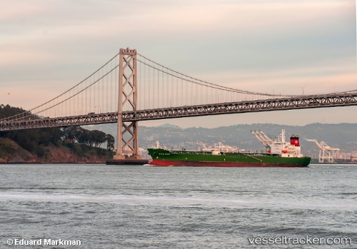
 Golden State
Current Status
Where is the vessel?
Golden State is currently in 11 nm S of Cameron, based on AIS data received about 1h ago.
Latest AIS update:
Current position: 29.60043° N, 93.25709° W (11 nm S of Cameron)
Average speed (last 7 days): Loading…
Average speed (last 30 days): Loading…
Vessel profile: Golden State is a Chemical Oil Products Tanker with dimensions 183m x 32m.
This page combines live AIS, route history, probable destination signals, nearby traffic, and port activity for practical vessel monitoring.
The current position of vessel Golden State is 29.60043 lat / -93.25709 lng. Updated: 2026-05-14 22:11:27 UTCNearest reference points:
- Near Carlyss
- Near Lake Charles
- Near Lake Arthur
Currently sailing under the flag of USA ![]()
Golden State built in 2008 year
Deadweight:
48632 tDetails:
Live Vessel Golden State Analytics (details, animations, etc.)
Recent AIS points (UTC):
2026-05-14 19:05:28 UTC · 29.59875, -93.25986 · SOG 0.1 kn · COG 38°2026-05-14 20:05:28 UTC · 29.59839, -93.25911 · SOG 0.1 kn · COG 5°
2026-05-14 22:02:28 UTC · 29.60035, -93.25710 · SOG 0.1 kn · COG 248°
2026-05-14 22:11:27 UTC · 29.60043, -93.25709 · SOG 0 kn · COG 243°