 vesseltracker.com
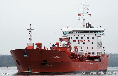
 FURE SPEAR
Current Status
Where is the vessel?
FURE SPEAR is currently in 29 nm NW of Hirtshals, based on AIS data received less than 1h ago.
Latest AIS update:
Current position: 57.92493° N, 9.31167° E (29 nm NW of Hirtshals)
Average speed (last 7 days): Loading…
Average speed (last 30 days): Loading…
Vessel profile: FURE SPEAR is a Chemical Oil Products Tanker with dimensions 144m x 23m.
This page combines live AIS, route history, probable destination signals, nearby traffic, and port activity for practical vessel monitoring.
The current position of vessel FURE SPEAR is 57.92493 lat / 9.31167 lng. Updated: 2026-05-16 14:07:15 UTCNearest reference points:
- 28 nm NW of Lokken
- 27 nm N of HANSTHOLM
- 15 nm N of Hirtshals
Currently sailing under the flag of Faroe Is ![]()
FURE SPEAR built in 2009 year
Deadweight:
16585 tDetails:
Live Vessel FURE SPEAR Analytics (details, animations, etc.)
Recent AIS points (UTC):
2026-05-16 10:03:03 UTC · 57.10859, 8.08517 · SOG 15.2 kn · COG 33°2026-05-16 12:23:24 UTC · 57.58446, 8.76852 · SOG 16 kn · COG 40°
2026-05-16 14:01:02 UTC · 57.90500, 9.27955 · SOG 15.2 kn · COG 41°
2026-05-16 14:07:15 UTC · 57.92493, 9.31167 · SOG 15.2 kn · COG 41°