 vesseltracker.com
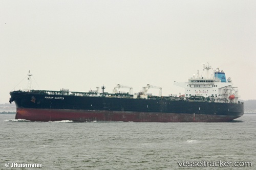
 P. SOPHIA
Current Status
Where is the vessel?
P. SOPHIA is currently in 152 nm W of Sungai Besi, based on AIS data received less than 1h ago.
Latest AIS update:
Current position: 2.45972° N, 104.16985° W (152 nm W of Sungai Besi)
Average speed (last 7 days): Loading…
Average speed (last 30 days): Loading…
Vessel profile: P. SOPHIA is a Crude Oil Tanker with dimensions 244m x 244m.
This page combines live AIS, route history, probable destination signals, nearby traffic, and port activity for practical vessel monitoring.
The current position of vessel P. SOPHIA is 2.45972 lat / -104.16985 lng. Updated: 2026-04-27 22:25:08 UTCCurrently sailing under the flag of Marshall Islands ![]()
P. SOPHIA built in 2009 year
Deadweight:
105071 tDetails:
Live Vessel P. SOPHIA Analytics (details, animations, etc.)
Recent AIS points (UTC):
2026-04-27 19:02:06 UTC · 1.79480, -103.88303 · SOG 12.7 kn · COG 328°2026-04-27 19:43:43 UTC · 1.93160, -103.94195 · SOG 12.8 kn · COG 328°
2026-04-27 22:01:08 UTC · 2.38212, -104.13918 · SOG 12.9 kn · COG 332°
2026-04-27 22:25:08 UTC · 2.45972, -104.16985 · SOG 12.1 kn · COG 332°