 vesseltracker.com
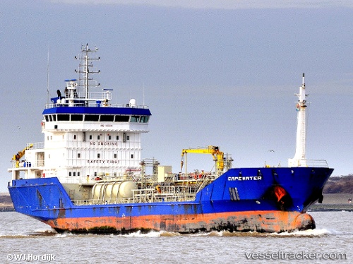
 Capewater
Current Status
Where is the vessel?
Capewater is currently in 14 nm SE of Saint Leonards-on-Sea, based on AIS data received less than 1h ago.
Latest AIS update:
Current position: 50.68781° N, 0.84456° E (14 nm SE of Saint Leonards-on-Sea)
Average speed (last 7 days): Loading…
Average speed (last 30 days): Loading…
Vessel profile: Capewater is a Chemical Oil Products Tanker with dimensions 100m x 16m.
This page combines live AIS, route history, probable destination signals, nearby traffic, and port activity for practical vessel monitoring.
The current position of vessel Capewater is 50.68781 lat / 0.84456 lng. Updated: 2026-05-15 01:15:45 UTCNearest reference points:
- Near Dungeness
- Near Saint Leonards-on-Sea
- 23 nm S of Poling
Currently sailing under the flag of Netherlands ![]()
Capewater built in 2009 year
Deadweight:
5180 tDetails:
Live Vessel Capewater Analytics (details, animations, etc.)
Recent AIS points (UTC):
2026-05-14 22:01:05 UTC · 51.10247, 1.56519 · SOG 10.3 kn · COG 228°2026-05-14 22:37:25 UTC · 51.02609, 1.45144 · SOG 10.4 kn · COG 221°
2026-05-14 23:58:44 UTC · 50.84361, 1.19275 · SOG 11.8 kn · COG 235°
2026-05-15 01:15:45 UTC · 50.68781, 0.84456 · SOG 13.2 kn · COG 235°