 vesseltracker.com
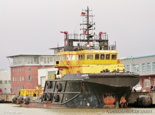
 Amber Ii
Current Status
Where is the vessel?
Amber Ii is currently in 33 nm N of Punta Alegre, based on AIS data received less than 1h ago.
Latest AIS update:
Current position: 22.90167° N, 78.93167° W (33 nm N of Punta Alegre)
Average speed (last 7 days): Loading…
Average speed (last 30 days): Loading…
Vessel profile: Amber Ii is a Offshore Support Vessel with dimensions 48m x 15m.
This page combines live AIS, route history, probable destination signals, nearby traffic, and port activity for practical vessel monitoring.
The current position of vessel Amber Ii is 22.90167 lat / -78.93167 lng. Updated: 2026-03-31 21:52:22 UTCNearest reference points:
- 36 nm E of Cayo Coco
- 28 nm NE of VARADERO
- 11 nm S of Lyford Cay
Currently sailing under the flag of Malta ![]()
Amber Ii built in 2007 year
Deadweight:
760 tDetails:
Live Vessel Amber Ii Analytics (details, animations, etc.)
Recent AIS points (UTC):
2026-03-31 15:34:18 UTC · 22.62500, -78.14833 · SOG 7 kn · COG -1°2026-03-31 17:28:18 UTC · 22.70167, -78.38833 · SOG 7 kn · COG -1°
2026-03-31 20:10:17 UTC · 22.83333, -78.73333 · SOG 7 kn · COG -1°
2026-03-31 21:52:22 UTC · 22.90167, -78.93167 · SOG 6 kn · COG -1°