 vesseltracker.com
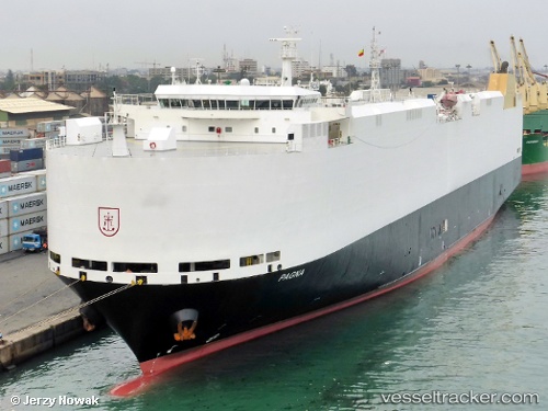
 PAGNA
PAGNA
Current Status
Where is the vessel?
PAGNA is currently in 27 nm E of YAMBA, based on AIS data received about 2h ago.
Latest AIS update:
Current position: 29.29848° S, 153.83643° E (27 nm E of YAMBA)
Average speed (last 7 days): Loading…
Average speed (last 30 days): Loading…
Vessel profile: PAGNA is a Vehicles Carrier with dimensions m x m.
This page combines live AIS, route history, probable destination signals, nearby traffic, and port activity for practical vessel monitoring.
The current position of vessel PAGNA is -29.29848 lat / 153.83643 lng. Updated: 2026-04-27 01:50:58 UTCNearest reference points:
- Near Gold Coast
- Near Labrador
- Near Biggera Waters
Currently sailing under the flag of Marshall Islands ![]()
Details:
Live Vessel PAGNA Analytics (details, animations, etc.)
Recent AIS points (UTC):
2026-04-26 22:39:09 UTC · -28.27660, 153.97495 · SOG 18.1 kn · COG 174°2026-04-27 00:20:16 UTC · -28.80413, 153.97243 · SOG 19.5 kn · COG 193°
2026-04-27 01:37:52 UTC · -29.22882, 153.85519 · SOG 20 kn · COG 195°
2026-04-27 01:50:58 UTC · -29.29848, 153.83643 · SOG 19.3 kn · COG 191°