 vesseltracker.com
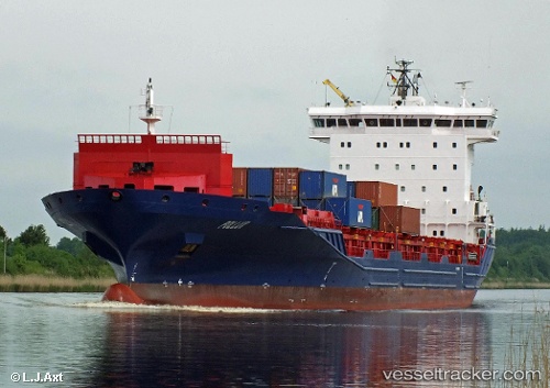
 Pollux
Current Status
Where is the vessel?
Pollux is currently in 24 nm SE of Sheet Harbour, based on AIS data received about 1h ago.
Latest AIS update:
Current position: 44.66476° N, 62.10707° W (24 nm SE of Sheet Harbour)
Average speed (last 7 days): Loading…
Average speed (last 30 days): Loading…
Vessel profile: Pollux is a Container Ship with dimensions 158m x 23m.
This page combines live AIS, route history, probable destination signals, nearby traffic, and port activity for practical vessel monitoring.
The current position of vessel Pollux is 44.66476 lat / -62.10707 lng. Updated: 2026-04-08 05:44:44 UTCNearest reference points:
- Near Goldboro
- 20 nm S of Head of Jeddore
- 31 nm SE of Bald Rock
Currently sailing under the flag of Antigua Barbuda ![]()
Pollux built in 2009 year
Deadweight:
14800 tDetails:
Live Vessel Pollux Analytics (details, animations, etc.)
Recent AIS points (UTC):
2026-04-08 00:19:09 UTC · 44.62619, -63.55966 · SOG 0 kn · COG 146°2026-04-08 01:27:54 UTC · 44.45979, -63.48693 · SOG 14.7 kn · COG 154°
2026-04-08 03:55:07 UTC · 44.50821, -62.68624 · SOG 14.4 kn · COG 70°
2026-04-08 05:44:44 UTC · 44.66476, -62.10707 · SOG 14.5 kn · COG 69°