 vesseltracker.com
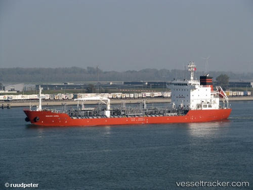
 MARITIM INDONESIA
Current Status
Where is the vessel?
MARITIM INDONESIA is currently in Near CIWANDAN, based on AIS data received less than 1h ago.
Latest AIS update:
Current position: 5.98007° S, 105.94586° E (Near CIWANDAN)
Average speed (last 7 days): Loading…
Average speed (last 30 days): Loading…
Vessel profile: MARITIM INDONESIA is a Chemical/Oil Products Tanker with dimensions 128m x 128m.
This page combines live AIS, route history, probable destination signals, nearby traffic, and port activity for practical vessel monitoring.
The current position of vessel MARITIM INDONESIA is -5.98007 lat / 105.94586 lng. Updated: 2026-05-15 13:22:29 UTCNearest reference points:
- Near CIWANDAN
- Near Cigading
- Near MERAK
Currently sailing under the flag of Indonesia ![]()
MARITIM INDONESIA built in 2008 year
Deadweight:
13224 tDetails:
Live Vessel MARITIM INDONESIA Analytics (details, animations, etc.)
Recent AIS points (UTC):
2026-05-15 10:22:28 UTC · -5.97980, 105.94573 · SOG 0 kn · COG 30°2026-05-15 10:58:25 UTC · -5.97980, 105.94557 · SOG 0 kn · COG 40°
2026-05-15 11:34:27 UTC · -5.97998, 105.94597 · SOG 0 kn · COG 16°
2026-05-15 13:22:29 UTC · -5.98007, 105.94586 · SOG 0.1 kn · COG 27°