 vesseltracker.com
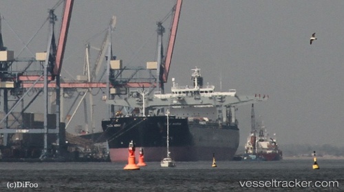
Tuju Arrow
Current StatusWhere is the vessel?
Tuju Arrow is currently in Near Taicang, based on AIS data received less than 1h ago.
Latest AIS update:
Current position: 31.64104° N, 121.25495° E (Near Taicang)
Average speed (last 7 days): Loading…
Average speed (last 30 days): Loading…
Vessel profile: Tuju Arrow is a Bulk Carrier with dimensions 32m x 225m.
This page combines live AIS, route history, probable destination signals, nearby traffic, and port activity for practical vessel monitoring.
The current position of vessel Tuju Arrow is 31.64104 lat / 121.25495 lng. Updated: 2026-05-17 20:02:45 UTCNearest reference points:
- Near Taicang
- Near Chongming
- Near Jiading
Details:
Live Vessel Tuju Arrow Analytics (details, animations, etc.)
Recent AIS points (UTC):
2026-05-17 15:47:47 UTC · 31.64107, 121.25319 · SOG 0 kn · COG 144°2026-05-17 16:29:46 UTC · 31.64062, 121.25294 · SOG 0 kn · COG 144°
2026-05-17 17:59:45 UTC · 31.64031, 121.25287 · SOG 0 kn · COG 147°
2026-05-17 20:02:45 UTC · 31.64104, 121.25495 · SOG 0.2 kn · COG 194°