 vesseltracker.com
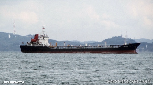
 AVA
AVA
Current Status
Where is the vessel?
AVA is currently in 53 nm NE of Belawan, based on AIS data received about 2h ago.
Latest AIS update:
Current position: 4.52406° N, 99.16607° E (53 nm NE of Belawan)
Average speed (last 7 days): Loading…
Average speed (last 30 days): Loading…
Vessel profile: AVA is a Oil Products Tanker with dimensions m x m.
This page combines live AIS, route history, probable destination signals, nearby traffic, and port activity for practical vessel monitoring.
The current position of vessel AVA is 4.52406 lat / 99.16607 lng. Updated: 2026-04-26 07:51:49 UTCNearest reference points:
- 43 nm NE of PANGKALAN SUSU
- 43 nm NE of Perbaungan
- 10 nm NE of Belawan
Currently sailing under the flag of Sierra Leone ![]()
Details:
Live Vessel AVA Analytics (details, animations, etc.)
Recent AIS points (UTC):
2026-04-26 04:26:45 UTC · 4.31776, 99.37143 · SOG 6.7 kn · COG -1°2026-04-26 05:27:16 UTC · 4.39316, 99.28271 · SOG 6.9 kn · COG -1°
2026-04-26 07:33:54 UTC · 4.49576, 99.19306 · SOG 7.7 kn · COG -1°
2026-04-26 07:51:49 UTC · 4.52406, 99.16607 · SOG 7.8 kn · COG -1°