 vesseltracker.com
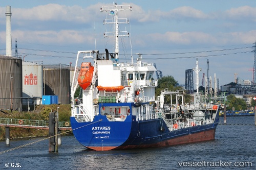
 ANTARES
Current Status
Where is the vessel?
ANTARES is currently in 56 nm SE of Covent Garden, based on AIS data received less than 1h ago.
Latest AIS update:
Current position: 50.88097° N, 6.89143° W (56 nm SE of Covent Garden)
Average speed (last 7 days): Loading…
Average speed (last 30 days): Loading…
Vessel profile: ANTARES is a Oil/Chemical Tanker with dimensions m x m.
This page combines live AIS, route history, probable destination signals, nearby traffic, and port activity for practical vessel monitoring.
The current position of vessel ANTARES is 50.88097 lat / -6.89143 lng. Updated: 2026-05-16 01:23:30 UTCNearest reference points:
- 45 nm SE of Covent Garden
- Near Isles of Scilly
- 10 nm NW of Grampound
Currently sailing under the flag of Portugal ![]()
Details:
Live Vessel ANTARES Analytics (details, animations, etc.)
Recent AIS points (UTC):
2026-05-15 21:27:44 UTC · 51.29498, -7.55957 · SOG 9 kn · COG 131°2026-05-15 22:39:57 UTC · 51.16910, -7.35410 · SOG 8.9 kn · COG 129°
2026-05-15 23:41:53 UTC · 51.06090, -7.18044 · SOG 9 kn · COG 133°
2026-05-16 01:23:30 UTC · 50.88097, -6.89143 · SOG 9 kn · COG 134°