 vesseltracker.com
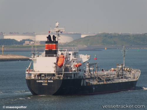
Chemstar Masa
Current StatusWhere is the vessel?
Chemstar Masa is currently in 14 nm SE of ZHOUSHAN, based on AIS data received about 2h ago.
Latest AIS update:
Current position: 29.77355° N, 122.36333° E (14 nm SE of ZHOUSHAN)
Average speed (last 7 days): Loading…
Average speed (last 30 days): Loading…
Vessel profile: Chemstar Masa is a Chemical Oil Products Tanker with dimensions 24m x 148m.
This page combines live AIS, route history, probable destination signals, nearby traffic, and port activity for practical vessel monitoring.
The current position of vessel Chemstar Masa is 29.77355 lat / 122.36333 lng. Updated: 2026-05-15 00:15:37 UTCNearest reference points:
- 12 nm SE of ZHOUSHAN
- 16 nm SE of ZHOUSHAN
- Near ZHOUSHAN
Details:
Live Vessel Chemstar Masa Analytics (details, animations, etc.)
Recent AIS points (UTC):
2026-05-14 19:57:36 UTC · 29.77142, 122.36348 · SOG 0 kn · COG 53°2026-05-14 21:24:36 UTC · 29.77203, 122.36265 · SOG 0 kn · COG 84°
2026-05-14 22:18:38 UTC · 29.77240, 122.36263 · SOG 0 kn · COG 90°
2026-05-15 00:15:37 UTC · 29.77355, 122.36333 · SOG 0 kn · COG 150°