 vesseltracker.com
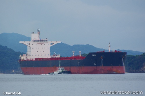
 OJAS
OJAS
Current Status
Where is the vessel?
OJAS is currently in Near ITAGUAI, based on AIS data received less than 1h ago.
Latest AIS update:
Current position: 22.93652° S, 43.82845° W (Near ITAGUAI)
Average speed (last 7 days): Loading…
Average speed (last 30 days): Loading…
Vessel profile: OJAS is a Bulk Carrier with dimensions 45m x 290m.
This page combines live AIS, route history, probable destination signals, nearby traffic, and port activity for practical vessel monitoring.
The current position of vessel OJAS is -22.93652 lat / -43.82845 lng. Updated: 2026-04-25 01:08:15 UTCNearest reference points:
- Near ILHA GUAIBA
- Near SANTA RITA
- Near CUNHAMBEBE
Currently sailing under the flag of Panama ![]()
OJAS built in 2011 year
Deadweight:
175264 tDetails:
Live Vessel OJAS Analytics (details, animations, etc.)
Recent AIS points (UTC):
2026-04-24 21:56:13 UTC · -22.93649, -43.82844 · SOG 0 kn · COG 265°2026-04-24 22:41:03 UTC · -22.93659, -43.82844 · SOG 0 kn · COG 265°
2026-04-24 23:50:09 UTC · -22.93649, -43.82843 · SOG 0 kn · COG 265°
2026-04-25 01:08:15 UTC · -22.93652, -43.82845 · SOG 0 kn · COG 265°