 vesseltracker.com
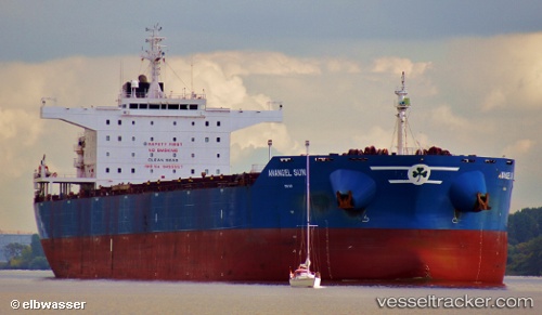
 MARINE HONESTY
Current Status
Where is the vessel?
MARINE HONESTY is currently in Near Albatross Bay, based on AIS data received about 2h ago.
Latest AIS update:
Current position: 12.75859° S, 141.55013° E (Near Albatross Bay)
Average speed (last 7 days): Loading…
Average speed (last 30 days): Loading…
Vessel profile: MARINE HONESTY is a Bulk Carrier with dimensions m x m.
This page combines live AIS, route history, probable destination signals, nearby traffic, and port activity for practical vessel monitoring.
The current position of vessel MARINE HONESTY is -12.75859 lat / 141.55013 lng. Updated: 2026-04-29 13:45:47 UTCNearest reference points:
- Near Torres Strait
- Near Thursday Island
Currently sailing under the flag of Liberia ![]()
Details:
Live Vessel MARINE HONESTY Analytics (details, animations, etc.)
Recent AIS points (UTC):
2026-04-29 10:09:44 UTC · -12.75889, 141.55003 · SOG 0.1 kn · COG 124°2026-04-29 12:09:46 UTC · -12.75874, 141.55000 · SOG 0 kn · COG 125°
2026-04-29 13:45:47 UTC · -12.75859, 141.55013 · SOG 0.1 kn · COG 130°
2026-04-29 13:45:47 UTC · -12.75859, 141.55013 · SOG 0.1 kn · COG 130°