 vesseltracker.com
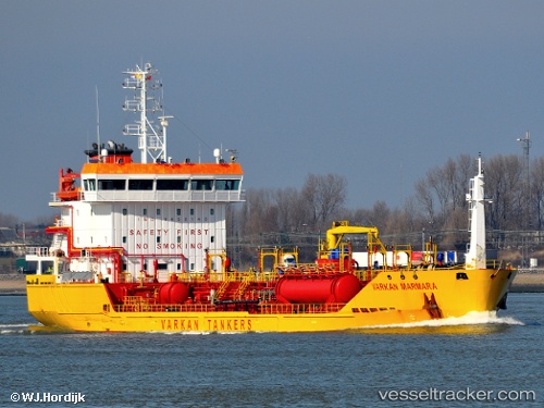
 Varkan Marmara
Current Status
Where is the vessel?
Varkan Marmara is currently in 28 nm SE of Cornwall, based on AIS data received less than 1h ago.
Latest AIS update:
Current position: 49.73467° N, 3.62417° W (28 nm SE of Cornwall)
Average speed (last 7 days): Loading…
Average speed (last 30 days): Loading…
Vessel profile: Varkan Marmara is a Chemical Tanker with dimensions 100m x 16m.
This page combines live AIS, route history, probable destination signals, nearby traffic, and port activity for practical vessel monitoring.
The current position of vessel Varkan Marmara is 49.73467 lat / -3.62417 lng. Updated: 2026-05-15 16:33:55 UTCNearest reference points:
- 27 nm N of Verzy
- 12 nm S of Cornwall
- Near Dartmouth
Currently sailing under the flag of Turkey ![]()
Varkan Marmara built in 2009 year
Deadweight:
4865 tDetails:
Live Vessel Varkan Marmara Analytics (details, animations, etc.)
Recent AIS points (UTC):
2026-05-15 13:05:36 UTC · 50.02717, -2.83200 · SOG 12.9 kn · COG 253°2026-05-15 13:49:46 UTC · 49.96367, -3.04533 · SOG 11.9 kn · COG 239°
2026-05-15 15:59:37 UTC · 49.77457, -3.51672 · SOG 8.7 kn · COG 242°
2026-05-15 16:33:55 UTC · 49.73467, -3.62417 · SOG 8.4 kn · COG 243°