 vesseltracker.com
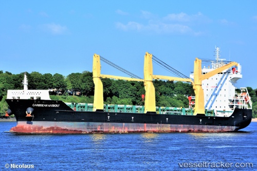
Caribbean Harmony
Current StatusWhere is the vessel?
Caribbean Harmony is currently in 21 nm NE of Putian, based on AIS data received less than 1h ago.
Latest AIS update:
Current position: 24.57889° N, 119.36739° E (21 nm NE of Putian)
Average speed (last 7 days): Loading…
Average speed (last 30 days): Loading…
Vessel profile: Caribbean Harmony is a Multi Purpose Carrier with dimensions 28m x 166m.
This page combines live AIS, route history, probable destination signals, nearby traffic, and port activity for practical vessel monitoring.
The current position of vessel Caribbean Harmony is 24.57889 lat / 119.36739 lng. Updated: 2026-04-02 11:38:06 UTCNearest reference points:
- 19 nm NE of Putian
- 23 nm SE of XIUYU
- 17 nm SW of Damaiyu
Details:
Live Vessel Caribbean Harmony Analytics (details, animations, etc.)
Recent AIS points (UTC):
2026-04-02 04:08:08 UTC · 25.46385, 120.23304 · SOG 10.6 kn · COG 215°2026-04-02 07:44:07 UTC · 24.95782, 119.83346 · SOG 9.4 kn · COG 225°
2026-04-02 09:37:54 UTC · 24.75284, 119.62559 · SOG 8.6 kn · COG -1°
2026-04-02 11:38:06 UTC · 24.57889, 119.36739 · SOG 9.1 kn · COG -1°