 vesseltracker.com
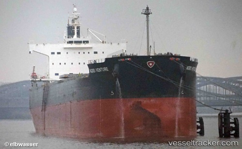
 NEA TYHI
Current Status
Where is the vessel?
NEA TYHI is currently in 23 nm N of Krueng Geukueh, based on AIS data received less than 1h ago.
Latest AIS update:
Current position: 5.63667° N, 97.02500° E (23 nm N of Krueng Geukueh)
Average speed (last 7 days): Loading…
Average speed (last 30 days): Loading…
Vessel profile: NEA TYHI is a Bulk Carrier with dimensions m x m.
This page combines live AIS, route history, probable destination signals, nearby traffic, and port activity for practical vessel monitoring.
The current position of vessel NEA TYHI is 5.63667 lat / 97.02500 lng. Updated: 2026-05-16 04:16:41 UTCNearest reference points:
- 45 nm NE of Krueng Geukueh
- 34 nm N of Langsa Venture FPSO
- 45 nm N of Langsa Venture FPSO
Currently sailing under the flag of Greece ![]()
Details:
Live Vessel NEA TYHI Analytics (details, animations, etc.)
Recent AIS points (UTC):
2026-05-16 01:43:42 UTC · 5.73833, 96.57500 · SOG 11 kn · COG -1°2026-05-16 02:19:44 UTC · 5.71333, 96.68167 · SOG 10 kn · COG -1°
2026-05-16 03:25:44 UTC · 5.67167, 96.87167 · SOG 10 kn · COG -1°
2026-05-16 04:16:41 UTC · 5.63667, 97.02500 · SOG 11 kn · COG -1°