 vesseltracker.com
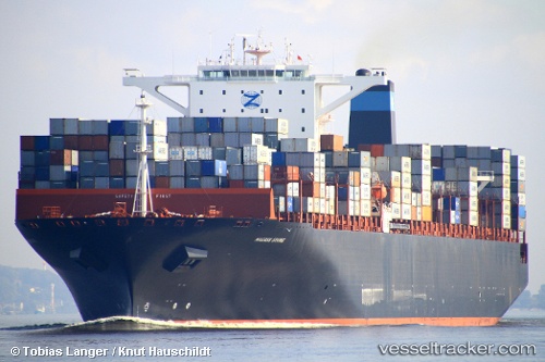
 Erving
Current Status
Where is the vessel?
Erving is currently in 240 nm S of Aquiraz, based on AIS data received less than 1h ago.
Latest AIS update:
Current position: 7.77625° S, 27.48548° W (240 nm S of Aquiraz)
Average speed (last 7 days): Loading…
Average speed (last 30 days): Loading…
Vessel profile: Erving is a Container Ship with dimensions 366m x 48m.
This page combines live AIS, route history, probable destination signals, nearby traffic, and port activity for practical vessel monitoring.
The current position of vessel Erving is -7.77625 lat / -27.48548 lng. Updated: 2026-05-17 18:07:48 UTCNearest reference points:
- Open sea, approx. 402 nm off the nearest listed port
- Open sea, approx. 403 nm off the nearest listed port
- Open sea, approx. 404 nm off the nearest listed port
Currently sailing under the flag of United Kingdom ![]()
Erving built in 2011 year
Deadweight:
141377 tDetails:
Live Vessel Erving Analytics (details, animations, etc.)
Recent AIS points (UTC):
2026-05-17 14:26:17 UTC · -7.21179, -28.12473 · SOG 13.8 kn · COG 131°2026-05-17 16:09:38 UTC · -7.47541, -27.82641 · SOG 13.8 kn · COG 131°
2026-05-17 16:45:45 UTC · -7.56720, -27.72232 · SOG 13.7 kn · COG 131°
2026-05-17 18:07:48 UTC · -7.77625, -27.48548 · SOG 13.7 kn · COG 131°