 vesseltracker.com
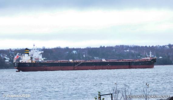
 Amalfi
Current Status
Where is the vessel?
Amalfi is currently in 126 nm SW of Wanam, based on AIS data received less than 1h ago.
Latest AIS update:
Current position: 8.89400° S, 137.46992° E (126 nm SW of Wanam)
Average speed (last 7 days): Loading…
Average speed (last 30 days): Loading…
Vessel profile: Amalfi is a Bulk Carrier with dimensions 224m x 32m.
This page combines live AIS, route history, probable destination signals, nearby traffic, and port activity for practical vessel monitoring.
The current position of vessel Amalfi is -8.89400 lat / 137.46992 lng. Updated: 2026-05-15 09:29:46 UTCNearest reference points:
- 131 nm SW of Wanam
- 137 nm N of Elizabeth Bay
- 34 nm NW of MERAUKE
Currently sailing under the flag of Malta ![]()
Amalfi built in 2009 year
Deadweight:
75206 tDetails:
Live Vessel Amalfi Analytics (details, animations, etc.)
Recent AIS points (UTC):
2026-05-15 05:43:45 UTC · -8.59803, 136.78152 · SOG 11.6 kn · COG 112°2026-05-15 06:51:09 UTC · -8.68296, 136.98508 · SOG 11.5 kn · COG 113°
2026-05-15 07:34:26 UTC · -8.74157, 137.11490 · SOG 11.5 kn · COG 112°
2026-05-15 09:29:46 UTC · -8.89400, 137.46992 · SOG 12 kn · COG 116°