 vesseltracker.com
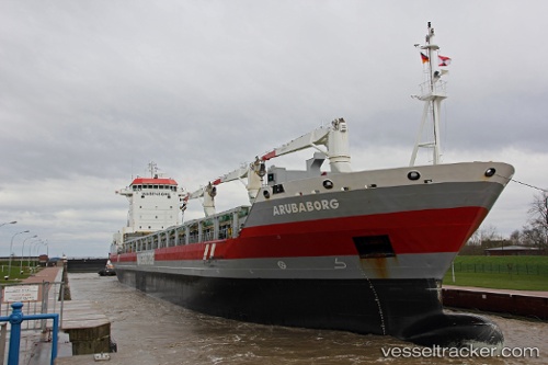
Arubaborg
Current StatusWhere is the vessel?
Arubaborg is currently in 100 nm N of Langa de Duero, based on AIS data received less than 1h ago.
Latest AIS update:
Current position: 43.27887° N, 32.47074° W (100 nm N of Langa de Duero)
Average speed (last 7 days): Loading…
Average speed (last 30 days): Loading…
Vessel profile: Arubaborg is a Multi Purpose Carrier with dimensions 22m x 143m.
This page combines live AIS, route history, probable destination signals, nearby traffic, and port activity for practical vessel monitoring.
The current position of vessel Arubaborg is 43.27887 lat / -32.47074 lng. Updated: 2026-05-15 13:37:30 UTCNearest reference points:
- 165 nm N of Villagonzalo Pedernales
Details:
Live Vessel Arubaborg Analytics (details, animations, etc.)
Recent AIS points (UTC):
2026-05-15 10:46:18 UTC · 43.25667, -33.41333 · SOG 14 kn · COG -1°2026-05-15 12:02:16 UTC · 43.26614, -32.99860 · SOG 14.4 kn · COG 89°
2026-05-15 13:13:25 UTC · 43.27560, -32.60461 · SOG 14.6 kn · COG 90°
2026-05-15 13:37:30 UTC · 43.27887, -32.47074 · SOG 14.8 kn · COG 91°