 vesseltracker.com
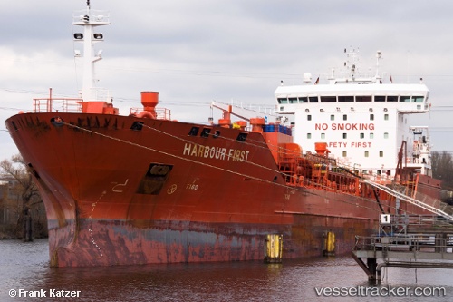
 Harbour First
Current Status
Where is the vessel?
Harbour First is currently in 11 nm S of Ambarli, based on AIS data received less than 1h ago.
Latest AIS update:
Current position: 40.78940° N, 28.64933° E (11 nm S of Ambarli)
Average speed (last 7 days): Loading…
Average speed (last 30 days): Loading…
Vessel profile: Harbour First is a Chemical Oil Products Tanker with dimensions 144m x 23m.
This page combines live AIS, route history, probable destination signals, nearby traffic, and port activity for practical vessel monitoring.
The current position of vessel Harbour First is 40.78940 lat / 28.64933 lng. Updated: 2026-05-15 22:09:39 UTCNearest reference points:
- 16 nm S of Kumport
- Near Ambarli
- Near Gürpinar
Currently sailing under the flag of Portugal ![]()
Harbour First built in 2011 year
Deadweight:
16894 tDetails:
Live Vessel Harbour First Analytics (details, animations, etc.)
Recent AIS points (UTC):
2026-05-15 19:22:25 UTC · 40.72269, 27.78510 · SOG 14.4 kn · COG 80°2026-05-15 19:29:28 UTC · 40.72808, 27.82210 · SOG 14.5 kn · COG 83°
2026-05-15 21:51:45 UTC · 40.80835, 28.55705 · SOG 14.6 kn · COG 80°
2026-05-15 22:09:39 UTC · 40.78940, 28.64933 · SOG 15.2 kn · COG 112°