 vesseltracker.com
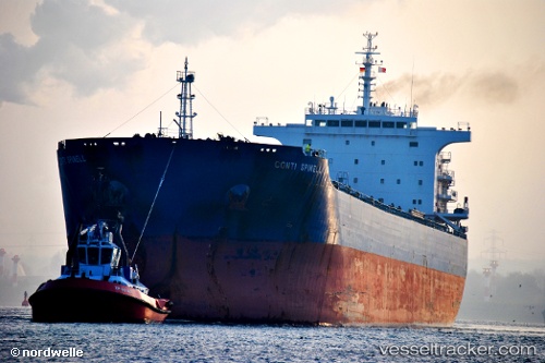
 NESTOR S
Current Status
Where is the vessel?
NESTOR S is currently in Near Kaliorang, based on AIS data received less than 1h ago.
Latest AIS update:
Current position: 0.78777° N, 117.89029° E (Near Kaliorang)
Average speed (last 7 days): Loading…
Average speed (last 30 days): Loading…
Vessel profile: NESTOR S is a Bulk Carrier with dimensions m x m.
This page combines live AIS, route history, probable destination signals, nearby traffic, and port activity for practical vessel monitoring.
The current position of vessel NESTOR S is 0.78777 lat / 117.89029 lng. Updated: 2026-05-15 11:34:43 UTCNearest reference points:
- Near LUBUKTUTUNG
- Near TANJUNG BARA
- Near Santan Terminal
Currently sailing under the flag of Greece ![]()
Details:
Live Vessel NESTOR S Analytics (details, animations, etc.)
Recent AIS points (UTC):
2026-05-15 08:19:44 UTC · 0.78782, 117.89041 · SOG 0.6 kn · COG 0°2026-05-15 10:22:42 UTC · 0.78792, 117.89037 · SOG 0.2 kn · COG 358°
2026-05-15 11:01:45 UTC · 0.78768, 117.89061 · SOG 0.2 kn · COG 350°
2026-05-15 11:34:43 UTC · 0.78777, 117.89029 · SOG 0.3 kn · COG 3°