 vesseltracker.com
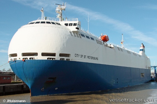
 City Ofst.petersburg
Current Status
Where is the vessel?
City Ofst.petersburg is currently in Near Howdon, based on AIS data received less than 1h ago.
Latest AIS update:
Current position: 54.98525° N, 1.46423° W (Near Howdon)
Average speed (last 7 days): Loading…
Average speed (last 30 days): Loading…
Vessel profile: City Ofst.petersburg is a Vehicles Carrier with dimensions 140m x 22m.
This page combines live AIS, route history, probable destination signals, nearby traffic, and port activity for practical vessel monitoring.
The current position of vessel City Ofst.petersburg is 54.98525 lat / -1.46423 lng. Updated: 2026-05-12 22:12:21 UTCNearest reference points:
- Near TYNE
- Near Blyth
- Near North Berwick
Currently sailing under the flag of Panama ![]()
City Ofst.petersburg built in 2010 year
Deadweight:
5000 tDetails:
Live Vessel City Ofst.petersburg Analytics (details, animations, etc.)
Recent AIS points (UTC):
2026-05-12 19:12:20 UTC · 54.98530, -1.46422 · SOG 0 kn · COG 123°2026-05-12 20:05:26 UTC · 54.98500, -1.46333 · SOG 0 kn · COG -1°
2026-05-12 21:30:22 UTC · 54.98522, -1.46437 · SOG 0 kn · COG 123°
2026-05-12 22:12:21 UTC · 54.98525, -1.46423 · SOG 0 kn · COG 123°