 vesseltracker.com
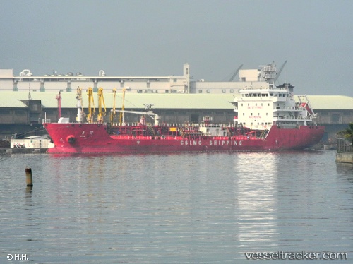
 LUCAS
LUCAS
Current Status
Where is the vessel?
LUCAS is currently in Near JURONG ISLAND, based on AIS data received about 1h ago.
Latest AIS update:
Current position: 1.20222° N, 103.67968° E (Near JURONG ISLAND)
Average speed (last 7 days): Loading…
Average speed (last 30 days): Loading…
Vessel profile: LUCAS is a Tanker B with dimensions m x m.
This page combines live AIS, route history, probable destination signals, nearby traffic, and port activity for practical vessel monitoring.
The current position of vessel LUCAS is 1.20222 lat / 103.67968 lng. Updated: 2026-04-24 20:04:27 UTCNearest reference points:
- Near JURONG ISLAND
- Near BUKOM ISLAND
- Near Pulau Ayer Chawan
Currently sailing under the flag of Panama ![]()
Details:
Live Vessel LUCAS Analytics (details, animations, etc.)
Recent AIS points (UTC):
2026-04-24 16:52:27 UTC · 1.20137, 103.67975 · SOG 0 kn · COG 64°2026-04-24 17:55:30 UTC · 1.20145, 103.67972 · SOG 0.1 kn · COG 63°
2026-04-24 19:43:26 UTC · 1.20227, 103.67972 · SOG 0 kn · COG 113°
2026-04-24 20:04:27 UTC · 1.20222, 103.67968 · SOG 0 kn · COG 109°