 vesseltracker.com
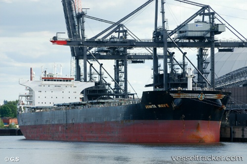
Denita Wave
Current StatusWhere is the vessel?
Denita Wave is currently in 104 nm NE of PANGKAL BALAM, based on AIS data received about 3h ago.
Latest AIS update:
Current position: 0.72518° S, 107.19094° E (104 nm NE of PANGKAL BALAM)
Average speed (last 7 days): Loading…
Average speed (last 30 days): Loading…
Vessel profile: Denita Wave is a Bulk Carrier with dimensions 38m x 229m.
This page combines live AIS, route history, probable destination signals, nearby traffic, and port activity for practical vessel monitoring.
The current position of vessel Denita Wave is -0.72518 lat / 107.19094 lng. Updated: 2026-05-12 20:12:48 UTCNearest reference points:
- 69 nm NE of Exspan
- 46 nm NW of Tanjung Pandan
- 74 nm N of Belitung
Details:
Live Vessel Denita Wave Analytics (details, animations, etc.)
Recent AIS points (UTC):
2026-05-12 17:17:21 UTC · -0.26654, 106.78434 · SOG 12.7 kn · COG 138°2026-05-12 19:28:08 UTC · -0.60977, 107.08713 · SOG 12.5 kn · COG 138°
2026-05-12 20:12:48 UTC · -0.72518, 107.19094 · SOG 12.4 kn · COG 135°
2026-05-12 20:12:48 UTC · -0.72518, 107.19094 · SOG 12.4 kn · COG 135°