 vesseltracker.com
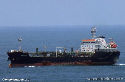
 FILIPPA
Current Status
Where is the vessel?
FILIPPA is currently in Near Maracaibo, based on AIS data received about 1h ago.
Latest AIS update:
Current position: 10.59500° N, 71.58167° W (Near Maracaibo)
Average speed (last 7 days): Loading…
Average speed (last 30 days): Loading…
Vessel profile: FILIPPA is a Tanker with dimensions m x m.
This page combines live AIS, route history, probable destination signals, nearby traffic, and port activity for practical vessel monitoring.
The current position of vessel FILIPPA is 10.59500 lat / -71.58167 lng. Updated: 2026-05-15 11:24:35 UTCNearest reference points:
- Near Bachaquero
- Near PUERTO BOLIVAR
- Near Las Piedras
Details:
Live Vessel FILIPPA Analytics (details, animations, etc.)
Recent AIS points (UTC):
2026-05-15 08:03:31 UTC · 10.59500, -71.58167 · SOG 0 kn · COG -1°2026-05-15 09:42:33 UTC · 10.59500, -71.58167 · SOG 0 kn · COG -1°
2026-05-15 10:54:35 UTC · 10.59500, -71.58167 · SOG 0 kn · COG -1°
2026-05-15 11:24:35 UTC · 10.59500, -71.58167 · SOG 0 kn · COG -1°