 vesseltracker.com
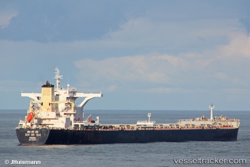
 ES BROAD SEA
Current Status
Where is the vessel?
ES BROAD SEA is currently in Near Richards Bay, based on AIS data received less than 1h ago.
Latest AIS update:
Current position: 28.88033° S, 32.20364° E (Near Richards Bay)
Average speed (last 7 days): Loading…
Average speed (last 30 days): Loading…
Vessel profile: ES BROAD SEA is a Bulk Carrier with dimensions m x m.
This page combines live AIS, route history, probable destination signals, nearby traffic, and port activity for practical vessel monitoring.
The current position of vessel ES BROAD SEA is -28.88033 lat / 32.20364 lng. Updated: 2026-05-15 11:37:49 UTCNearest reference points:
- 42 nm E of Richards Bay
- Near Umhlanga Rocks
- Near Durban
Currently sailing under the flag of Hong Kong ![]()
Details:
Live Vessel ES BROAD SEA Analytics (details, animations, etc.)
Recent AIS points (UTC):
2026-05-15 07:52:00 UTC · -28.87833, 32.20667 · SOG 0 kn · COG -1°2026-05-15 09:40:44 UTC · -28.87899, 32.20588 · SOG 0 kn · COG 157°
2026-05-15 10:28:47 UTC · -28.87972, 32.20472 · SOG 0.2 kn · COG 136°
2026-05-15 11:37:49 UTC · -28.88033, 32.20364 · SOG 0.7 kn · COG 116°