 vesseltracker.com
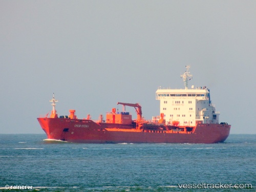
 Chem Hydra
Current Status
Where is the vessel?
Chem Hydra is currently in 36 nm SE of Quintana, based on AIS data received less than 1h ago.
Latest AIS update:
Current position: 28.63976° N, 94.68451° W (36 nm SE of Quintana)
Average speed (last 7 days): Loading…
Average speed (last 30 days): Loading…
Vessel profile: Chem Hydra is a Chemical Oil Products Tanker with dimensions 144m x 24m.
This page combines live AIS, route history, probable destination signals, nearby traffic, and port activity for practical vessel monitoring.
The current position of vessel Chem Hydra is 28.63976 lat / -94.68451 lng. Updated: 2026-05-14 17:35:02 UTCNearest reference points:
- 39 nm S of Sheppard
- 43 nm SE of Sheppard
- 49 nm SE of Sheppard
Currently sailing under the flag of Liberia ![]()
Chem Hydra built in 2009 year
Deadweight:
17055 tDetails:
Live Vessel Chem Hydra Analytics (details, animations, etc.)
Recent AIS points (UTC):
2026-05-14 13:22:58 UTC · 28.64032, -94.68332 · SOG 0 kn · COG 285°2026-05-14 16:08:53 UTC · 28.63833, -94.68333 · SOG 0 kn · COG -1°
2026-05-14 16:14:07 UTC · 28.63998, -94.68381 · SOG 0 kn · COG 316°
2026-05-14 17:35:02 UTC · 28.63976, -94.68451 · SOG 0.1 kn · COG 346°