 vesseltracker.com
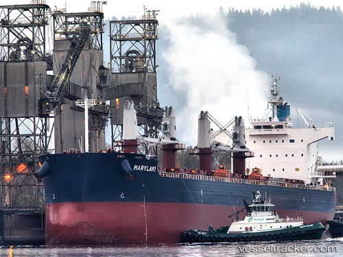
 Marylaki
Current Status
Where is the vessel?
Marylaki is currently in Near Mardyck, based on AIS data received about 1h ago.
Latest AIS update:
Current position: 51.04500° N, 2.28333° E (Near Mardyck)
Average speed (last 7 days): Loading…
Average speed (last 30 days): Loading…
Vessel profile: Marylaki is a Bulk Carrier with dimensions 190m x 190m.
This page combines live AIS, route history, probable destination signals, nearby traffic, and port activity for practical vessel monitoring.
The current position of vessel Marylaki is 51.04500 lat / 2.28333 lng. Updated: 2026-05-15 07:37:49 UTCNearest reference points:
- Near Dunkerque
- Near ARQUES
- Near Calais
Currently sailing under the flag of Marshall Is ![]()
Marylaki built in 2010 year
Deadweight:
58114 tDetails:
Live Vessel Marylaki Analytics (details, animations, etc.)
Recent AIS points (UTC):
2026-05-15 04:41:16 UTC · 51.04501, 2.28382 · SOG 0 kn · COG 73°2026-05-15 06:18:55 UTC · 51.04501, 2.28382 · SOG 0 kn · COG 73°
2026-05-15 07:08:23 UTC · 51.04500, 2.28385 · SOG 0 kn · COG 73°
2026-05-15 07:37:49 UTC · 51.04500, 2.28333 · SOG 0 kn · COG -1°