 vesseltracker.com
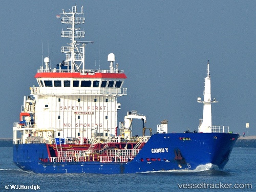
 CANSU Y
Current Status
Where is the vessel?
CANSU Y is currently in Near Cobn, based on AIS data received less than 1h ago.
Latest AIS update:
Current position: 51.75993° N, 8.27247° W (Near Cobn)
Average speed (last 7 days): Loading…
Average speed (last 30 days): Loading…
Vessel profile: CANSU Y is a Oil/Chemical Tanker with dimensions m x m.
This page combines live AIS, route history, probable destination signals, nearby traffic, and port activity for practical vessel monitoring.
The current position of vessel CANSU Y is 51.75993 lat / -8.27247 lng. Updated: 2026-05-15 03:45:38 UTCNearest reference points:
- Near Cobn
- Near Covent Garden
- Near HELVICK
Currently sailing under the flag of Barbados ![]()
Details:
Live Vessel CANSU Y Analytics (details, animations, etc.)
Recent AIS points (UTC):
2026-05-14 22:57:42 UTC · 51.75958, -8.27327 · SOG 0 kn · COG 340°2026-05-14 23:48:38 UTC · 51.75965, -8.27293 · SOG 0 kn · COG 334°
2026-05-15 01:09:42 UTC · 51.75990, -8.27265 · SOG 0 kn · COG 314°
2026-05-15 03:45:38 UTC · 51.75993, -8.27247 · SOG 0 kn · COG 316°