 vesseltracker.com
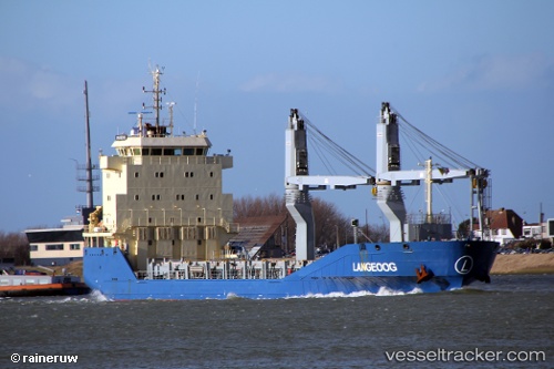
 Langeoog
Current Status
Where is the vessel?
Langeoog is currently in 32 nm NW of Santa Marta, based on AIS data received less than 1h ago.
Latest AIS update:
Current position: 11.54190° N, 74.67500° W (32 nm NW of Santa Marta)
Average speed (last 7 days): Loading…
Average speed (last 30 days): Loading…
Vessel profile: Langeoog is a Multi Purpose Carrier with dimensions 108m x 16m.
This page combines live AIS, route history, probable destination signals, nearby traffic, and port activity for practical vessel monitoring.
The current position of vessel Langeoog is 11.54190 lat / -74.67500 lng. Updated: 2026-05-13 17:57:14 UTCNearest reference points:
- 18 nm N of Santa Marta
- Near Santa Marta
- Near Sociedad Portuaria Regional Cartagena
Currently sailing under the flag of Antigua Barbuda ![]()
Details:
Live Vessel Langeoog Analytics (details, animations, etc.)
Recent AIS points (UTC):
2026-05-13 13:18:15 UTC · 11.48500, -75.09333 · SOG 5 kn · COG -1°2026-05-13 16:04:28 UTC · 11.51509, -74.84902 · SOG 4.8 kn · COG 82°
2026-05-13 16:15:59 UTC · 11.51655, -74.83265 · SOG 5.1 kn · COG 84°
2026-05-13 17:57:14 UTC · 11.54190, -74.67500 · SOG 6 kn · COG 81°