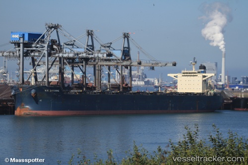
.
Vessel photo of STAR MARILENA (IMO 9507520) vesseltracker.com

LB flag STAR MARILENA

Vessel type: Bulk Carrier | IMO: 9507520 | MMSI: MMSI: 636020572
Call sign: A8UT7 | Dimensions: 45 m x 292 m
Current Status

Where is the vessel?

STAR MARILENA is currently in 37 nm W of Antique Evelio Javier Apt, based on AIS data received about 1h ago.

Latest AIS update:

Current position: 10.93833° N, 121.33667° E (37 nm W of Antique Evelio Javier Apt)

Average speed (last 7 days): Loading…

Average speed (last 30 days): Loading…

Vessel profile: STAR MARILENA is a Bulk Carrier with dimensions 45m x 292m.

This page combines live AIS, route history, probable destination signals, nearby traffic, and port activity for practical vessel monitoring.

The current position of vessel STAR MARILENA is 10.93833 lat / 121.33667 lng. Updated: 2026-03-26 10:07:57 UTC
Nearest reference points:
  • Near Iloilo
  • 19 nm NE of CORON
  • Near BACOLOD

Currently sailing under the flag of Liberia LB flag

STAR MARILENA built in 2010 year

Deadweight:
178978 t

Details:

Live Vessel STAR MARILENA Analytics (details, animations, etc.)


Recent AIS points (UTC):
2026-03-26 04:06:41 UTC · 12.27790, 120.91849 · SOG 13.6 kn · COG -1°
2026-03-26 05:15:10 UTC · 12.04265, 121.00979 · SOG 13.3 kn · COG -1°
2026-03-26 07:55:40 UTC · 11.46214, 121.24001 · SOG 14.1 kn · COG -1°
2026-03-26 10:07:57 UTC · 10.93833, 121.33667 · SOG 14 kn · COG -1°

Track of the vessel in the last 28 days


UTC: --
Start: -- Track timeline (UTC) End: --
Encountered: --


Link to the map:


Find another ship

STAR_MARILENA (636020572) last ports (portcalls and passsages)

PORT WALCOTT | 2025-09-08 11:06:47
Qingdao | 2025-08-12 09:27:00
PENGERANG | 2025-07-30 10:22:54
TANAH MERAH | 2025-07-29 19:43:11
BATU AMPAR | 2025-07-29 18:52:06
PULAU SAMBU | 2025-07-29 17:45:38
PULAU SAMBU | 2025-05-11 02:57:25
BATU AMPAR | 2025-05-11 02:11:17
TANAH MERAH | 2025-05-10 02:24:48
PENGERANG | 2025-05-10 01:09:58
Jingjiang | 2025-04-30 05:47:49
Jingjiang | 2025-03-27 00:24:32
JINGTANG | 2025-03-23 05:30:38
Qingdao | 2025-03-19 06:07:08
PENGERANG | 2025-03-04 18:54:11
TANAH MERAH | 2025-03-04 18:20:08
BATU AMPAR | 2025-03-04 16:29:57
PULAU SAMBU | 2025-03-04 15:20:20
BUKOM ISLAND | 2025-03-04 14:45:35
TARIFA | 2024-12-17 09:19:35
CARTEYA GUADARRANQUE | 2024-12-15 14:14:31
MISURATA | 2024-12-08 10:16:30
MISURATA | 2024-12-04 09:24:45
MISURATA | 2024-11-30 08:59:08
TARIFA | 2024-11-25 10:48:34
Strait Of Gibraltar | 2024-11-25 09:59:29
PONTA UBU | 2024-11-06 20:31:26
Singapore | 2024-09-23 11:48:39
Lianyungang | 2024-08-22 10:59:28
Selat Lombok | 2024-08-06 23:25:02
Dampier | 2024-08-02 15:13:32
Yen-Tai | 2024-07-13 04:03:22
Yen-Tai | 2024-07-09 03:55:30
Singapore | 2024-06-27 02:08:32
Algeciras | 2024-05-04 20:26:50
Port Said | 2024-04-26 13:31:26
Ayn Sukhnah | 2024-04-25 08:17:18
Ayn Sukhnah | 2024-04-18 05:04:33
Bur Ibrahim | 2024-04-15 16:09:32
Port Said | 2024-04-15 06:13:51
Strait Of Gibraltar | 2024-04-06 18:47:35
Tubarao | 2024-03-20 07:58:50
Sambu | 2024-02-07 08:52:15
Kao-Hsiung Kang | 2024-01-29 00:59:36
Taicang | 2024-01-24 10:28:13
Wusong | 2024-01-24 04:23:15
Jingjiang | 2024-01-23 22:17:22
Newcastle | 2023-11-07 06:03:16
Taicang | 2023-10-17 07:03:48
Wusong | 2023-10-17 04:29:47
Jingjiang | 2023-10-17 00:17:47
Selat Lombok | 2023-10-02 20:47:37
Port Headland | 2023-09-28 16:25:04
Selat Lombok | 2023-09-24 08:33:46
Taicang | 2023-09-15 02:01:24
Nantong | 2023-09-12 08:17:06
Wusong | 2023-09-12 03:10:00
Jingjiang | 2023-09-11 21:47:59
Singapore | 2023-08-25 06:32:18
Richards Bay | 2023-04-30 22:05:22
Port Headland | 2023-02-07 15:14:19