 vesseltracker.com
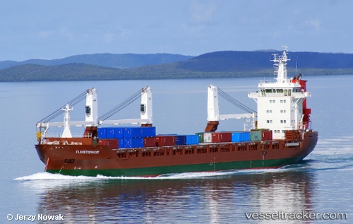
 FLORETGRACHT
Current Status
Where is the vessel?
FLORETGRACHT is currently in Near BANGOR, based on AIS data received about 1h ago.
Latest AIS update:
Current position: 54.68600° N, 5.68642° W (Near BANGOR)
Average speed (last 7 days): Loading…
Average speed (last 30 days): Loading…
Vessel profile: FLORETGRACHT is a General Cargo Ship with dimensions m x m.
This page combines live AIS, route history, probable destination signals, nearby traffic, and port activity for practical vessel monitoring.
The current position of vessel FLORETGRACHT is 54.68600 lat / -5.68642 lng. Updated: 2026-05-13 10:45:31 UTCNearest reference points:
- Near Belfast
- Near Crossgar
- Near Southend
Currently sailing under the flag of Netherlands ![]()
FLORETGRACHT built in 2012 year
Deadweight:
12067 tDetails:
Live Vessel FLORETGRACHT Analytics (details, animations, etc.)
Recent AIS points (UTC):
2026-05-13 04:03:20 UTC · 54.68685, -5.68556 · SOG 0.2 kn · COG 297°2026-05-13 06:12:51 UTC · 54.68637, -5.68605 · SOG 0.1 kn · COG 315°
2026-05-13 10:21:22 UTC · 54.68622, -5.68622 · SOG 0.5 kn · COG 296°
2026-05-13 10:45:31 UTC · 54.68600, -5.68642 · SOG 0.4 kn · COG 311°