 vesseltracker.com
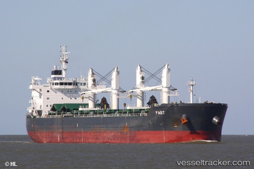
 FAST
FAST
Current Status
Where is the vessel?
FAST is currently in 106 nm E of Kefar Yona, based on AIS data received less than 1h ago.
Latest AIS update:
Current position: 32.90212° N, 32.95078° W (106 nm E of Kefar Yona)
Average speed (last 7 days): Loading…
Average speed (last 30 days): Loading…
Vessel profile: FAST is a Bulk Carrier with dimensions 188m x 32m.
This page combines live AIS, route history, probable destination signals, nearby traffic, and port activity for practical vessel monitoring.
The current position of vessel FAST is 32.90212 lat / -32.95078 lng. Updated: 2026-05-17 21:46:48 UTCNearest reference points:
- 107 nm SE of Sariseki
Currently sailing under the flag of Marshall Islands ![]()
FAST built in 2012 year
Deadweight:
55398 tDetails:
Live Vessel FAST Analytics (details, animations, etc.)
Recent AIS points (UTC):
2026-05-17 17:20:47 UTC · 32.77913, -33.98524 · SOG 11.9 kn · COG 83°2026-05-17 19:33:08 UTC · 32.83940, -33.46883 · SOG 12 kn · COG 85°
2026-05-17 19:43:46 UTC · 32.84382, -33.42719 · SOG 11.9 kn · COG 83°
2026-05-17 21:46:48 UTC · 32.90212, -32.95078 · SOG 12.1 kn · COG 84°