 vesseltracker.com
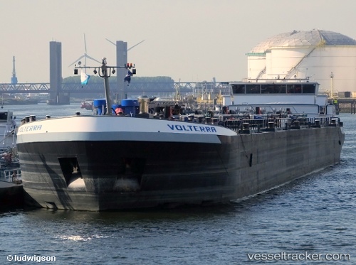
 Volterra
Current Status
Where is the vessel?
Volterra is currently in Near Maassluis, based on AIS data received about 1h ago.
Latest AIS update:
Current position: 51.92174° N, 4.21823° E (Near Maassluis)
Average speed (last 7 days): Loading…
Average speed (last 30 days): Loading…
Vessel profile: Volterra is a Other Tanker with dimensions 136m x 16m.
This page combines live AIS, route history, probable destination signals, nearby traffic, and port activity for practical vessel monitoring.
The current position of vessel Volterra is 51.92174 lat / 4.21823 lng. Updated: 2026-05-12 19:55:37 UTCNearest reference points:
- Near Maassluis
- Near BRIELLE
- Near Zwartewaal
Currently sailing under the flag of Netherlands ![]()
Details:
Live Vessel Volterra Analytics (details, animations, etc.)
Recent AIS points (UTC):
2026-05-12 16:55:38 UTC · 51.92174, 4.21824 · SOG 0 kn · COG -1°2026-05-12 18:01:37 UTC · 51.92174, 4.21823 · SOG 0 kn · COG -1°
2026-05-12 19:19:37 UTC · 51.92173, 4.21823 · SOG 0 kn · COG -1°
2026-05-12 19:55:37 UTC · 51.92174, 4.21823 · SOG 0 kn · COG -1°