 vesseltracker.com
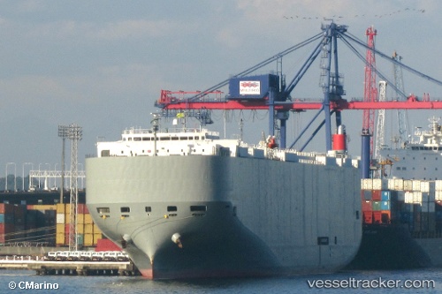
 Brasilia Highway
Current Status
Where is the vessel?
Brasilia Highway is currently in Near Campana, based on AIS data received about 1h ago.
Latest AIS update:
Current position: 34.13992° S, 58.98326° W (Near Campana)
Average speed (last 7 days): Loading…
Average speed (last 30 days): Loading…
Vessel profile: Brasilia Highway is a Vehicles Carrier with dimensions 199m x 32m.
This page combines live AIS, route history, probable destination signals, nearby traffic, and port activity for practical vessel monitoring.
The current position of vessel Brasilia Highway is -34.13992 lat / -58.98326 lng. Updated: 2026-05-13 06:34:18 UTCNearest reference points:
- Near Avellaneda
- Near Dock Sur
- 10 nm NW of San Pedro
Currently sailing under the flag of Panama ![]()
Brasilia Highway built in 2009 year
Deadweight:
18793 tDetails:
Live Vessel Brasilia Highway Analytics (details, animations, etc.)
Recent AIS points (UTC):
2026-05-13 02:35:42 UTC · -34.55953, -58.29621 · SOG 13.9 kn · COG 313°2026-05-13 04:01:57 UTC · -34.30593, -58.50981 · SOG 12.6 kn · COG 308°
2026-05-13 04:36:02 UTC · -34.26632, -58.64365 · SOG 10.6 kn · COG 287°
2026-05-13 06:34:18 UTC · -34.13992, -58.98326 · SOG 9.7 kn · COG 327°