 vesseltracker.com
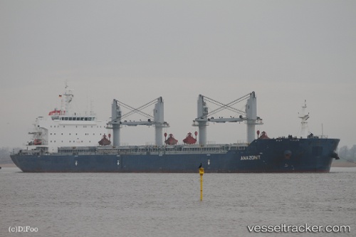
 MINOAS
Current Status
Where is the vessel?
MINOAS is currently in 89 nm NW of Saint Louis, based on AIS data received about 19h ago.
Latest AIS update:
Current position: 16.91092° N, 17.74461° W (89 nm NW of Saint Louis)
Average speed (last 7 days): Loading…
Average speed (last 30 days): Loading…
Vessel profile: MINOAS is a Bulk Carrier with dimensions 32m x 190m.
This page combines live AIS, route history, probable destination signals, nearby traffic, and port activity for practical vessel monitoring.
The current position of vessel MINOAS is 16.91092 lat / -17.74461 lng. Updated: 2026-04-02 06:22:43 UTCNearest reference points:
- 100 nm NW of Saint Louis
- 119 nm W of Nouakchott
- 90 nm W of Nouakchott
Currently sailing under the flag of Marshall Islands ![]()
MINOAS built in 2011 year
Deadweight:
56952 tDetails:
Live Vessel MINOAS Analytics (details, animations, etc.)
Recent AIS points (UTC):
2026-04-02 05:47:46 UTC · 17.02653, -17.74170 · SOG 11.9 kn · COG 181°2026-04-02 06:22:43 UTC · 16.91092, -17.74461 · SOG 11.8 kn · COG -1°
2026-04-02 06:22:43 UTC · 16.91092, -17.74461 · SOG 11.8 kn · COG -1°
2026-04-02 06:22:43 UTC · 16.91092, -17.74461 · SOG 11.8 kn · COG -1°