 vesseltracker.com
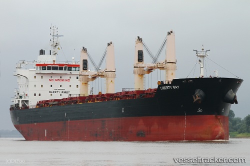
 LIBERTY BAY
Current Status
Where is the vessel?
LIBERTY BAY is currently in Near Mestre, based on AIS data received about 1h ago.
Latest AIS update:
Current position: 45.46250° N, 12.24780° E (Near Mestre)
Average speed (last 7 days): Loading…
Average speed (last 30 days): Loading…
Vessel profile: LIBERTY BAY is a Bulk Carrier with dimensions 186m x 28m.
This page combines live AIS, route history, probable destination signals, nearby traffic, and port activity for practical vessel monitoring.
The current position of vessel LIBERTY BAY is 45.46250 lat / 12.24780 lng. Updated: 2026-05-14 20:02:46 UTCNearest reference points:
- Near Marghera
- Near Venezia
- Near Murano
Currently sailing under the flag of Marshall Islands ![]()
LIBERTY BAY built in 2012 year
Deadweight:
36892 tDetails:
Live Vessel LIBERTY BAY Analytics (details, animations, etc.)
Recent AIS points (UTC):
2026-05-14 16:14:47 UTC · 45.46230, 12.24782 · SOG 0 kn · COG 323°2026-05-14 17:23:49 UTC · 45.46242, 12.24779 · SOG 0 kn · COG 324°
2026-05-14 19:41:47 UTC · 45.46245, 12.24783 · SOG 0 kn · COG 323°
2026-05-14 20:02:46 UTC · 45.46250, 12.24780 · SOG 0 kn · COG 323°