 vesseltracker.com
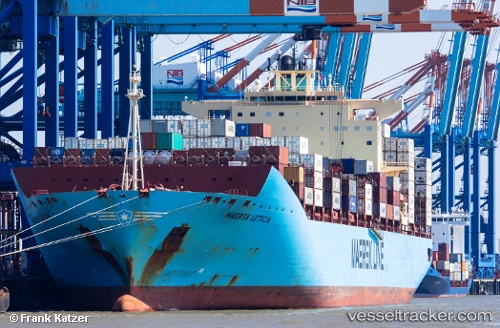
 MAERSK LETICIA
Current Status
Where is the vessel?
MAERSK LETICIA is currently in Near MAASVLAKTE - ROTTERDAM, based on AIS data received less than 1h ago.
Latest AIS update:
Current position: 51.95819° N, 4.04835° E (Near MAASVLAKTE - ROTTERDAM)
Average speed (last 7 days): Loading…
Average speed (last 30 days): Loading…
Vessel profile: MAERSK LETICIA is a Container Ship with dimensions m x m.
This page combines live AIS, route history, probable destination signals, nearby traffic, and port activity for practical vessel monitoring.
The current position of vessel MAERSK LETICIA is 51.95819 lat / 4.04835 lng. Updated: 2026-04-25 15:38:17 UTCNearest reference points:
- Near MAASVLAKTE - ROTTERDAM
- Near HOEK VAN HOLLAND
- Near Haarlemmermeer
Currently sailing under the flag of Denmark ![]()
Details:
Live Vessel MAERSK LETICIA Analytics (details, animations, etc.)
Recent AIS points (UTC):
2026-04-25 12:09:36 UTC · 51.95827, 4.04804 · SOG 0 kn · COG 83°2026-04-25 13:35:29 UTC · 51.95829, 4.04804 · SOG 0 kn · COG 83°
2026-04-25 14:17:18 UTC · 51.95828, 4.04796 · SOG 0 kn · COG 83°
2026-04-25 15:38:17 UTC · 51.95819, 4.04835 · SOG 0.1 kn · COG 83°