 vesseltracker.com
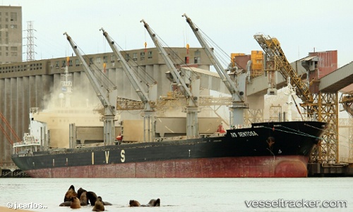
 ATHANASIA
Current Status
Where is the vessel?
ATHANASIA is currently in Near Almeirim, based on AIS data received about 1h ago.
Latest AIS update:
Current position: 1.57833° S, 52.55500° W (Near Almeirim)
Average speed (last 7 days): Loading…
Average speed (last 30 days): Loading…
Vessel profile: ATHANASIA is a Bulk Carrier with dimensions m x m.
This page combines live AIS, route history, probable destination signals, nearby traffic, and port activity for practical vessel monitoring.
The current position of vessel ATHANASIA is -1.57833 lat / -52.55500 lng. Updated: 2026-04-30 20:12:29 UTCNearest reference points:
- Near Santana
- 15 nm NW of SANTAREM
- 55 nm N of Tucuma
Currently sailing under the flag of Marshall Islands ![]()
Details:
Live Vessel ATHANASIA Analytics (details, animations, etc.)
Recent AIS points (UTC):
2026-04-30 16:12:30 UTC · -1.45167, -52.09833 · SOG 7 kn · COG -1°2026-04-30 17:52:53 UTC · -1.52950, -52.27299 · SOG 6.3 kn · COG 240°
2026-04-30 19:29:04 UTC · -1.57983, -52.46780 · SOG 7.9 kn · COG 265°
2026-04-30 20:12:29 UTC · -1.57833, -52.55500 · SOG 6 kn · COG -1°