 vesseltracker.com
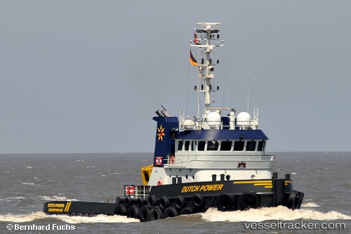
 Dutch Power
Current Status
Where is the vessel?
Dutch Power is currently in Near Blyth, based on AIS data received about 2h ago.
Latest AIS update:
Current position: 55.13645° N, 1.51594° W (Near Blyth)
Average speed (last 7 days): Loading…
Average speed (last 30 days): Loading…
Vessel profile: Dutch Power is a Tug with dimensions 30m x 31m.
This page combines live AIS, route history, probable destination signals, nearby traffic, and port activity for practical vessel monitoring.
The current position of vessel Dutch Power is 55.13645 lat / -1.51594 lng. Updated: 2026-03-26 18:18:02 UTCNearest reference points:
- Near Blyth
- Near TYNE
- Near North Berwick
Currently sailing under the flag of Netherlands ![]()
Dutch Power built in 2009 year
Deadweight:
130 tDetails:
Live Vessel Dutch Power Analytics (details, animations, etc.)
Recent AIS points (UTC):
2026-03-26 11:45:02 UTC · 55.13644, -1.51593 · SOG 0 kn · COG 154°2026-03-26 13:57:03 UTC · 55.13645, -1.51596 · SOG 0 kn · COG 154°
2026-03-26 15:42:02 UTC · 55.13646, -1.51595 · SOG 0 kn · COG 154°
2026-03-26 18:18:02 UTC · 55.13645, -1.51594 · SOG 0 kn · COG 153°