 vesseltracker.com
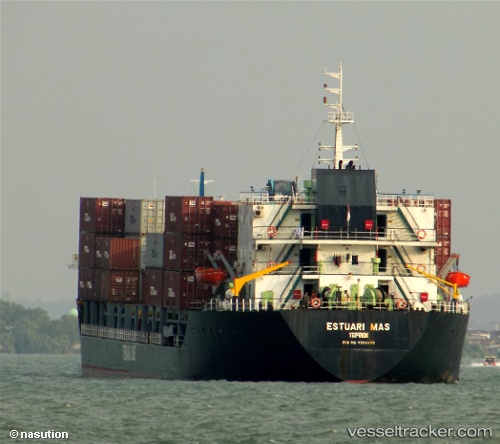
 Mv Estuari Mas
Current Status
Where is the vessel?
Mv Estuari Mas is currently in Near Jakarta, based on AIS data received less than 1h ago.
Latest AIS update:
Current position: 6.10070° S, 106.88805° E (Near Jakarta)
Average speed (last 7 days): Loading…
Average speed (last 30 days): Loading…
Vessel profile: Mv Estuari Mas is a Container Ship with dimensions 120m x 20m.
This page combines live AIS, route history, probable destination signals, nearby traffic, and port activity for practical vessel monitoring.
The current position of vessel Mv Estuari Mas is -6.10070 lat / 106.88805 lng. Updated: 2026-05-16 07:53:20 UTCNearest reference points:
- Near Jakarta
- Near Ancol
- Near New Priok Port
Currently sailing under the flag of Indonesia ![]()
Details:
Live Vessel Mv Estuari Mas Analytics (details, animations, etc.)
Recent AIS points (UTC):
2026-05-16 04:42:37 UTC · -6.10071, 106.88804 · SOG 0 kn · COG -1°2026-05-16 06:03:37 UTC · -6.10067, 106.88807 · SOG 0 kn · COG -1°
2026-05-16 07:46:00 UTC · -6.10069, 106.88807 · SOG 0 kn · COG -1°
2026-05-16 07:53:20 UTC · -6.10070, 106.88805 · SOG 0 kn · COG -1°