 vesseltracker.com
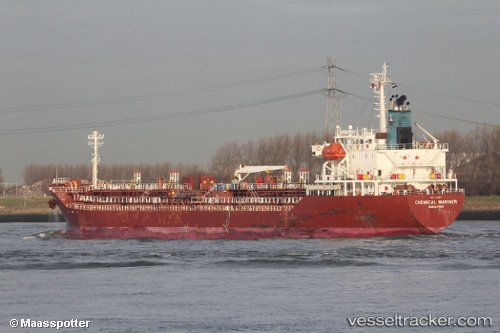
 CHEMICAL MARINER
Current Status
Where is the vessel?
CHEMICAL MARINER is currently in Near LAVERA, based on AIS data received less than 1h ago.
Latest AIS update:
Current position: 43.40070° N, 4.99775° E (Near LAVERA)
Average speed (last 7 days): Loading…
Average speed (last 30 days): Loading…
Vessel profile: CHEMICAL MARINER is a Oil/Chemical Tanker with dimensions m x m.
This page combines live AIS, route history, probable destination signals, nearby traffic, and port activity for practical vessel monitoring.
The current position of vessel CHEMICAL MARINER is 43.40070 lat / 4.99775 lng. Updated: 2026-05-16 14:01:03 UTCNearest reference points:
- Near Fos-sur-Mer
- Near SAINT LOUIS DU RHONE
- Near Marseille
Currently sailing under the flag of Malta ![]()
Details:
Live Vessel CHEMICAL MARINER Analytics (details, animations, etc.)
Recent AIS points (UTC):
2026-05-16 10:01:03 UTC · 43.40067, 4.99772 · SOG 0 kn · COG 319°2026-05-16 12:19:01 UTC · 43.40067, 4.99777 · SOG 0.1 kn · COG 319°
2026-05-16 14:01:03 UTC · 43.40070, 4.99775 · SOG 0 kn · COG 320°
2026-05-16 14:01:03 UTC · 43.40070, 4.99775 · SOG 0 kn · COG 320°