 vesseltracker.com
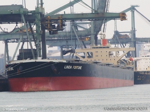
 Linda Fortune
Current Status
Where is the vessel?
Linda Fortune is currently in Near Thetis Island, based on AIS data received less than 1h ago.
Latest AIS update:
Current position: 49.01663° N, 123.62490° W (Near Thetis Island)
Average speed (last 7 days): Loading…
Average speed (last 30 days): Loading…
Vessel profile: Linda Fortune is a Bulk Carrier with dimensions 281m x 45m.
This page combines live AIS, route history, probable destination signals, nearby traffic, and port activity for practical vessel monitoring.
The current position of vessel Linda Fortune is 49.01663 lat / -123.62490 lng. Updated: 2026-05-02 16:22:00 UTCNearest reference points:
- Near Cassidy
- Near Harmac
- Near GANGES
Currently sailing under the flag of Panama ![]()
Linda Fortune built in 2010 year
Deadweight:
180242 tDetails:
Live Vessel Linda Fortune Analytics (details, animations, etc.)
Recent AIS points (UTC):
2026-05-02 13:52:00 UTC · 49.01542, -123.62573 · SOG 0 kn · COG 313°2026-05-02 14:22:00 UTC · 49.01538, -123.62563 · SOG 0 kn · COG 313°
2026-05-02 15:48:33 UTC · 49.01680, -123.62500 · SOG 0.1 kn · COG 273°
2026-05-02 16:22:00 UTC · 49.01663, -123.62490 · SOG 0 kn · COG 275°