 vesseltracker.com
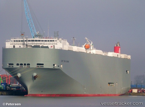
 Cape Town Highway
Current Status
Where is the vessel?
Cape Town Highway is currently in 21 nm NW of Mina Khalifa/Abu Dhabi, based on AIS data received about 1d ago.
Latest AIS update:
Current position: 25.02543° N, 54.33893° E (21 nm NW of Mina Khalifa/Abu Dhabi)
Average speed (last 7 days): Loading…
Average speed (last 30 days): Loading…
Vessel profile: Cape Town Highway is a Vehicles Carrier with dimensions 200m x 32m.
This page combines live AIS, route history, probable destination signals, nearby traffic, and port activity for practical vessel monitoring.
The current position of vessel Cape Town Highway is 25.02543 lat / 54.33893 lng. Updated: 2026-05-11 09:20:33 UTCNearest reference points:
- Near KHALIFA
- 11 nm SW of Fateh Terminal
- 16 nm NW of Jebel Ali
Currently sailing under the flag of Panama ![]()
Cape Town Highway built in 2011 year
Deadweight:
21676 tDetails:
Live Vessel Cape Town Highway Analytics (details, animations, etc.)
Recent AIS points (UTC):
2026-05-11 09:20:33 UTC · 25.02543, 54.33893 · SOG 0.1 kn · COG 254°2026-05-11 09:20:33 UTC · 25.02543, 54.33893 · SOG 0.1 kn · COG 254°
2026-05-11 09:20:33 UTC · 25.02543, 54.33893 · SOG 0.1 kn · COG 254°
2026-05-11 09:20:33 UTC · 25.02543, 54.33893 · SOG 0.1 kn · COG 254°