 vesseltracker.com
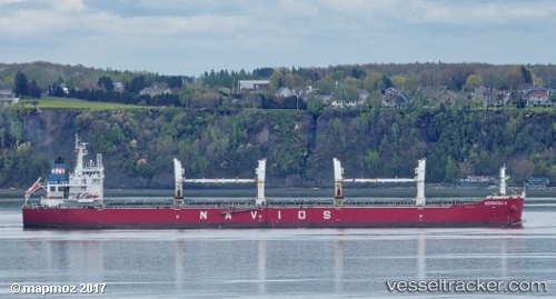
 MIKE THOMAS
Current Status
Where is the vessel?
MIKE THOMAS is currently in Near Ama, based on AIS data received less than 1h ago.
Latest AIS update:
Current position: 29.96503° N, 90.28035° W (Near Ama)
Average speed (last 7 days): Loading…
Average speed (last 30 days): Loading…
Vessel profile: MIKE THOMAS is a Bulk Carrier with dimensions m x m.
This page combines live AIS, route history, probable destination signals, nearby traffic, and port activity for practical vessel monitoring.
The current position of vessel MIKE THOMAS is 29.96503 lat / -90.28035 lng. Updated: 2026-04-26 09:53:49 UTCNearest reference points:
- Near Boutte
- Near Good Hope
- Near Marrero
Currently sailing under the flag of Portugal ![]()
Details:
Live Vessel MIKE THOMAS Analytics (details, animations, etc.)
Recent AIS points (UTC):
2026-04-26 06:21:11 UTC · 29.96507, -90.28033 · SOG 0 kn · COG 239°2026-04-26 07:35:52 UTC · 29.96505, -90.28033 · SOG 0 kn · COG 240°
2026-04-26 08:10:22 UTC · 29.96504, -90.28039 · SOG 0 kn · COG 240°
2026-04-26 09:53:49 UTC · 29.96503, -90.28035 · SOG 0 kn · COG 240°